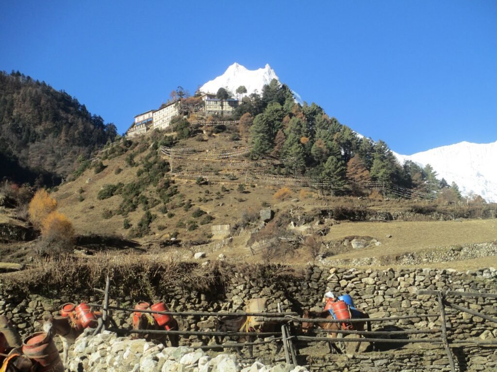
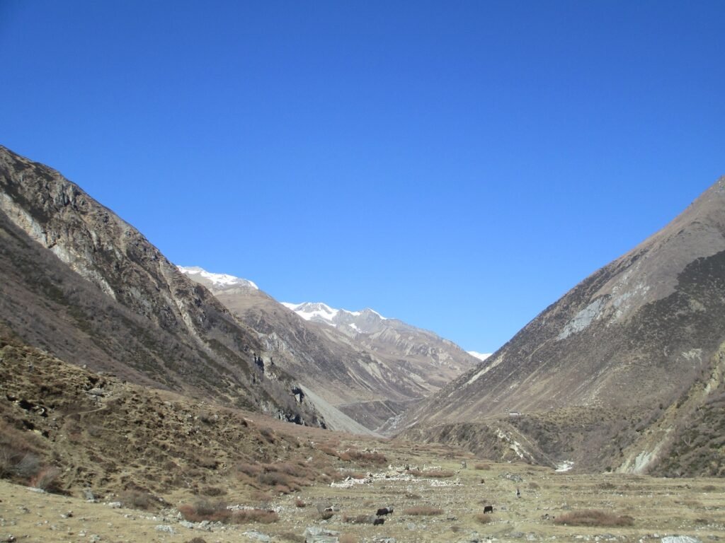
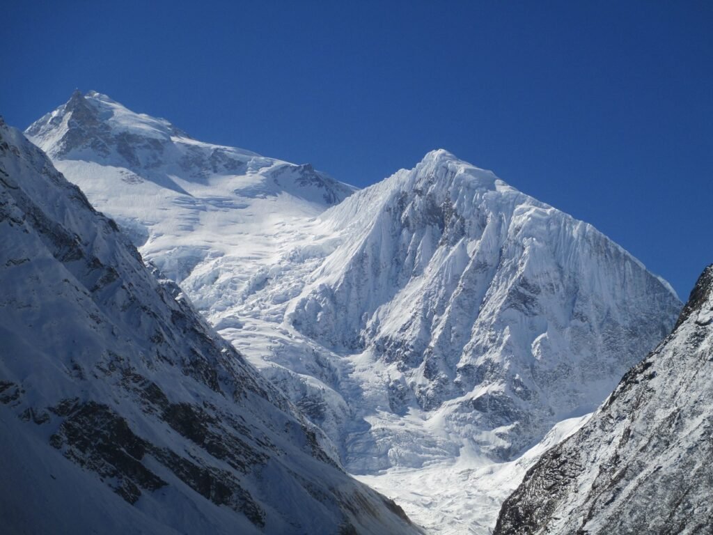
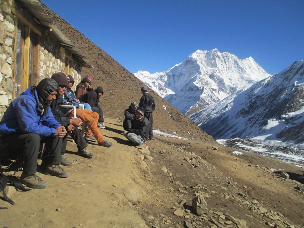
HERE WE GO !! SPELBOUND VIEWS OF MANASLU BASE CAMP !!!
Manaslu Trek in Nepal: Manaslu Base Camp Trekking is one of the popular trekking in Nepal Himalaya. It lies in the mid-western part of Nepal, in between Ganesh Himalayan ranges and Annapurna Himalayan Ranges. Budhi Gandaki river is the main river of this trekking which starts from Manaslu Base Camp (4800m).
Overview
Manaslu Mountain is located in the Gorkha district and Arughat is the gateway of this route. There are several routes but the main goal is Manaslu Base Camp and Manaslu circuit with Larkya-La pass 5106m. After reaching Sama Gaun, you will follow the northern route through Birendra lake and climb steeply uphill to Manaslu Base Camp. There is no tea house but there will be seasonal tents and camping places. The people who want to climb Manaslu Peak, they must follow this route.
It takes about 4 hours to climb from Sama Gaon and 3 hours back. Before reaching Manaslu Base Camp, you will observe the views of hidden valley Sama Gaun, Birendra Lake, samdo peak, Manaslu Peak, Naike Peak, Manaslu Glacier, and beautiful landscape with many more peaks of Manaslu area. The trekkers who will trek to the Manaslu area, we recommend visiting Manaslu Base Camp once for a lifetime memory. Going Manaslu base Camp:, Please, be prepare some energetic dry foods, pack lunch and plenty of water, camera, trekking stick, warm clothes, sunglass, Gloves, sun cream, lip care, snow getters, and trekking boots. You have to walk with one Guide OR with some friends. Please don’t go alone.
If in-case you need help, there is no any chance to communicate. The last part is invisible from the village and the chance to miss the way in there will be snow. Make sure about weather conditions before going Manaslu base Camp. Himalaya family adventure has professional staff who are doing Manaslu base Camp every season. Manaslu area treks are demanding trekking in Nepal.
Trip Highlights:
- Lovely views of cristaline rivers, lakes and waterfalls
- Stunning scene of Mt. Manaslu and many peaks
- Beautiful Sama Village and rural life
- Peaceful walks with professional guide
- Diversities of flora, fauna, herbs and plants
- Native Tibetan culture and typical lifestyle
- Glacial Lakes, Monasteries, Gompa and stupas
- Shelter of Yak, Sheep and wild animals
Itinerary
When you arrive at Tribhuvan International Airport (TIA), our company representative will welcome you and drive towards the designated hotel. After a rest for a while, we will give a short briefing about our program and you will be provided with a Typical Nepali welcome Dinner in the evening
Next day, we provide sightseeing guided by an expert to visit many beautiful places listed in the UNESCO heritage sites such as the Pashupatinath Temple, Boudhanath Stupa, Swoyambhunath Stupa, Durbar Square and many more
We start our journey early in the morning traveling by a tourist bus/Jeep from Kathmandu to Arughat via Dhadingbeshi, which is almost 126 km. from Kathmandu. The journey offers eye-catching views of wonderful hills, terrace farming, local villages, and some rivulets and rivers
After breakfast, we take a local transport up to Soti Khola through unpaved road, which allows us to witness lovely meadows and villages. Then, the trek through local villages on the left bank of Budhi Gandaki river is really delightful. It is normally hot and humid, so the main crops there include wet rice, maize, and millet and you may also see some wild animals mostly monkeys in the forests during the trip. The whole day trek through shady Sal forests with an exposed track blasted from the cliff and views below the wild rapids, eventually lead us to Lapubesi, and we spend the night there
When we take breakfast in the hotel, we will continue our trip walking up and down the hills, passing through Machhakhola on the same side of the Budhi Gandaki across sandy river flats. Large Gurung villages are there on the way while the track passes few houses in lower Khorlabeshi (960m), which was largely destroyed by a huge rock slip 24 years ago. Survivors have built a botanic garden and nice lodge, where we have a rest that night
On the sixth day, we continue the tour walking up and down over a couple of ridges to Tatopani, where there are several hot water spouts under the sheer cliffs that provide amusing showers that soften our skin due to natural minerals. Then, we climb over the ridge and cross the Budhi Gandaki with the help of a new suspension bridge under big cliffs and climb a little to Doban. The Shyaule Bhatti lodge is 40 minutes from there, and if we walk 20 more minutes, then we can reach Manaslu Santi and Thulodhunga (big rock) lodges, where we can rest for a while and take tea (if we like) looking at the wild gorges in front.
After passing Yaruphant (1140m), we cross the bridge of Yaru Khola (1363m) and emerge onto the river flats at Yaru (1140m), from where we can gaze the downstream with massive rockfall that chokes the river. Just past Yaru, our journey crosses to the true right bank of Budhi Gandaki and goes down to Jagat, a neatly flag-stoned village, where Jagat is collected in Tibetan trade. We need to show our MCAP permit to the officials there, which lies on the left. In this area, farmers mainly plant potato, maize and climbing beans at the same time; potato for food and to suppress weeds, maize for food and to supply a trellis for beans, which is an important source of protein. That night is spent at Jagat
On this day, we start walking up the riverbank and climbing over a rocky ridge to Salleri with fabulous views of Sringi/Ganesh Himal (7187m) and then descend to Sirdibas. We continue the trip through the left bank of the river, up and down before crossing the suspension bridge to the east bank of Budhi Gandaki and a tiring climb up to prosperous Philim surrounded by rich fields of maize, potato, and millet. There are a few shops and lodges. After having Lunch at Chisopani, we continue walking to Deng village through the forest, where we take a rest that night.
After taking breakfast, we continue the trip crossing the Budhi Gandaki river to the east, climb Rana (1980m) and pass Bihi Phedi with the trail up to the stone-carving village of Bihi (2130m). With the roaring sound of the river below, we continue the tour walking in and out of the continuous wild canyons, with a village perched in every conceivable cropping situation. After crossing the bridge, we, then climb shortly again before finally reaching Ghap. The Mani walls here and onwards as far as Bimthang often display intricate quality carvings of various postures of Buddha in meditation, incised in the hard local stone by a family of carvers from Bihi.
A side-trip from here to Prok (2380m), attracts every traveler and there is also an ACAP office and emergency radio service. Visitors can also have an excursion to Kal Tal (3685m; Kalchhuman Lake), from there. After having lunch at Ghap, we enter into a beautiful forest of fir and rhododendron with many attractive birds. Then we cross the north with a roaring narrow canyon below through the new suspension bridge watching grey langurs. The main trail now climbs on well-made stairs. After about an hour’s walk, we climb a zigzag from the river to the neat village of Namrung (2660 m.) with shops, restaurants in the flag-stoned square. At Namrung, WIFI and hot shower are available with nice/clean accommodation and we stay at a Guest House there
After Breakfast at Namrung, we walk through the village and the architectural characteristic of upper Nupri starts here, where we can see several houses gathered together with a common courtyard and livestock shelters on the ground floor with heavy wooden single roof and log stairs to dark verandahs. Then, we pass Mani walls, fields, and houses through Banjam, enter the fir, rhododendron, and oak forest before we climb Lihi (2900m). Most people in these villages and ahead wear traditional Tibetan dress with the children in small Chubas. There are some fine paintings particularly in Kani (gate arches) that we pass before Sho. Then, we have a leisurely walk onwards, in and out of gullies to Lho (3180m; Logoan) with the exceptional views of Manaslu (8163m) and Manaslu North (7157m) from the Mani wall at the far end of the village and from the Gompa on the hill to the west. We spend a night there
Normally, we walk only for few hours this day. The journey takes you into the mountains with time to enjoy and acclimatize and also experience the stupendous views of Manasalu. We have an easy walk to Shyala (3520m) up a pine and rhododendron gully with moss and gin-clear stream. From here, we can also enjoy 360° views of the places around us. Another easy hour to the large village of Samagaon offers inordinate views of Manaslu, beautiful old Monastery, typical Tibetan village, and many other mountains. A daylong acclimatization trip can be made from here to Pung Gyen Gompa or to Manaslu base camp (4900m). An afternoon walk to the Kargyu Chholing Gompa is also highly recommended.
After Breakfast at Samagaon, we start the trip to Pung Gyen Gompa (4200m.), a daylong acclimatization trip. For our trip, we have to take packed lunch, dry food and water with us because there are no shops to buy food and drink. The trail follows southwest ridge of Samagaon and a long climb up to Kharka with the views of Manaslu, Himalchuli, Nadi Chuli, Manaslu Glacier and many more. There are several seasonal yak/sheep sheds and the vast grassland for grazing. After visiting the Pung Gyen Gompa, we slowly come back to Samagaon and take some hot drinks/food and also spend the night.
Legend: In 1954, a Japanese team approaching from the Budhi Gandaki route to the peak faced a hostile group of villagers at Samagaon camp. The villagers thought that the previous expeditions had displeased the gods, causing the avalanches that destroyed the Pung-gyen Monastery and the death of 18 people. As a result of this hostility, the team made a hasty retreat to Ganesh Himal. To appease local sentiments, a large donation was made to rebuild the monastery. However, this philanthropic act did not ease the atmosphere of distrust and hostility towards Japanese expeditions. Although the expedition in 1956 successfully climbed the mountain, they faced a problem there. As a result, the next Japanese expedition only took place in 1971
After Breakfast at Samagaon, we hike up to the north of Pema Choling Monastery. The trail leads through the Glacial Birendra lake and continues into the forest and gently steep up to the impressive Manaslu Glacier to Manaslu Base Camp (4800m.). Trek to Manaslu Base Camp is a side trip from Samagaun, which takes around 5 hours to climb up to 4800m. to Base Camp and 3 hours to down to Samagaun. We must take plenty of energetic food and water with us and start early to enjoy the best view and avoid the scorching sun in the afternoon, which reflects light from the glacier. In the Expedition season, this camp is full of tents, climbers, guide/sherpas, and porters. The trail offers amazing views of Manaslu Glacier, Birendra lake, and typical village Samagaun.
The expedition group generally spends a night here and the local people help to carry all the stuff from Samagaun to Base Camp in the climbing period. While climbing up, as you gain the altitude, the scenery becomes more spectacular with the nearest glacier, Manaslu peak, Naike Peak, and the views of surrounding hills. The final part of the trip is to climb between 4400-4800m, which is steeper with snow and ice (seasonal). After reaching Manaslu Base Camp at 4800m, we feel like being in the paradise
When we take breakfast, we start our trek to Samdo. Normally, we walk for a few hours because of the high altitude and also to be prepared for Larkya-La pass. Trek from Sama to Samdo is easy walking through yak pastures up a broad valley with long Mani walls. On the way, Juniper trees line all around and we climb to a ridge and climb down to cross the Budhi Gandaki on a wooden bridge. It takes a few minutes to reach the Stupa above and Samdo (3870m), a very picturesque village dedicated to yak herding is just behind this. On the side of the valley, there is a standing view of Samdo Peak. The Larkya La trail is ahead up the valley and goes to the left. We can see also the main track for Tibet over the Lajya-La Pass (5098m.).
The first village and road in Tibet are about 2hrs from the pass but the access has been currently blocked by China even for locals. We may visit the typical old Tibetan village at Samdo and explore around the village.
After breakfast at Samdo, we start walking on a broad trail, dropping to cross the river and pass the trail to Tibet to the right and climb left after a Mani wall to reach Larke bazaar. Long back, there used to be a trade fair by Tibetans with their goods and products, which no longer prevails now. Then, we cross two ravines on narrow tracks, which is very icy in winter. After gradually climbing to the northwest side, we reach Dharamsala (Larke Phedi, Larkya rest house), which is now a seasonal village with freezing rooms and tents. The views are marvelous. We can see a large herd of blue sheep and also some Himalayan animals in this place. We normally stay in a tent here
On this day, we have to note that if snow has fallen overnight and there have been high winds, then there may be less snow as we climb making the pass still crossable. We climb steadily over the ridge behind Dharamsala and behind the large lateral moraine of the Larke Glacier. The climb is not difficult, but it is long and rocky underfoot, particularly as we top the moraine. Then, we descend past four frozen lakes and make a final tiring climb to the left up to Larkya La (5106m), marked by prayer flags. It takes about 3-5 hrs. to reach the pass and it can be very cold and windy with a risk of exposure, if under-equipped or ill. The peaks to the west are Himlung (7126m) near Tibet, Kang Guru (6981m) and Annapurna II (7937m) in the Annapurna range. There are several places where snow or ice would make the trip treacherous and some groups fix a rope on the steepest piece. Then, we make a long descent on loose gravel to a grassy moraine, where the angle eases. The track now runs left of the large lateral moraine, rocky at times, in a widening and beautiful valley all the long way to very scenic Bimthang (3720m; plain of sand), a descent of 1400 m., which takes about 3hrs. The views during the walk are huge icefalls and mountains in all directions, a medial glacial lake (Pongkar Tal) between the Pongkar and Salpudanda Glaciers, and the joining of these two glaciers with a third glacier to form the Bhimtang Glacier and its lateral moraine towers over Bimthang.
After we take breakfast at Bhimtang, we walk towards the south below Bimthang behind the moraine wall for some time before crossing the Bhimtang Glacier, which can be loose underfoot. Then, we climb up the far moraine wall quickly to avoid stone-fall and enter the beautiful forest. If you are in rhododendron season, the mauves, reds, pinks, and whites are stunning amongst the huge pines and the views of the back of Mt Manaslu are superb. After that, we descend rapidly along the true right bank of the aptly named Dudh Khola through Hompuk (3420m) in a forest clearing. Gentle riverside walking continues rapidly to Surki 2700 m. where we have our lunch. After lunch, the walk allows us to see many signs of a glacial flood, with tree trunks smashed and banks undermined, and also the track becoming quite rough. We need to climb steeply over a ridge and drop to Goa (2560m), the first real village after Samdo. The valley becomes more agricultural as we pass through fields and copses of oak and rhododendron. Then, we reach to Tilje village, pass under a stone arch, cross the Dudh Khola and descend rapidly towards the Marsyangdi valley to the north bank and climb up to join the main round-Annapurna trail, over the Marsyangdi River on a long suspension bridge. Then, we turn to the left to reach Dharapani (1963m) and spend the night there
We take breakfast at the guesthouse and take a Jeep to Besisahar. On the way, we enjoy the views of the Marshyangdi river, waterfalls, local villages, scenic mountains, and so on. It takes about 4/5 hours to reach Besisahar. Besisahar is the district headquarters of Lamjung district, where we can find several shops, banks, restaurants, hotels, and so on. We have free time to explore the city that day. This is the end of the trek, so the travelers generally enjoy dinner with their Nepali staff.
After breakfast at Besisahar, we take a tourist bus to Kathmandu. After about 2 hours, the road meets the regular Prithvi highway (KTM-Pokhara) at Dumre, and then it continues through the bank of the popular river, Trisuli. The last part of driving is uphill for a couple of hours before reaching Kathmandu valley.
This day is an extra day for relaxation and shopping. Farewell dinner with official staff is provided and the travelers have a complete rest at the hotel in Kathmandu.
Company representatives drop the guests to the airport safely on time and see them off.
Cost Included
- Airport Pick up by Tourist Car
- 4 Night Hotel in Kathmandu with a BB plan
- Guided Sightseeing in Kathmandu valley by car
- Transport from Kathmandu to Arughat
- Trekking Permit for Manaslu controlled area (Immigration)
- Entrance Permit for Manaslu Conservation Area
- Entrance permit for Annapurna Conservation Area
- Trekking Information Management Service Permit TIMS
- Transport from Dharapani to Besisahar by Jeep
- Transport from Besisahar to Kathmandu by tourist vehicle
- One English speaking Govt. License holder Guide during the trek
- Necessary of Porter (2 member=1 porters)
- guide-porters Food, accommodation, insurance, trekking gears
- Your Accommodation at the guest house during the trek
- Your Food (Breakfast-Lunch-Dinner) with hot drinks during the trek
- Trekking Map and First Aid Kit
- Govt. Taxes and service charge
Cost Excluded
- Nepal visa and International Air Tickets
- Food in Kathmandu accept Breakfast
- Any kinds of cold drinks and pot of hot drinks
- Bar Bills and Personal expenses (Phone, Laundry, dry food, etc..)
- Travel insurance and rescue flights, Additional activities
- Late arrival/departure, extra days due to weather and etc..
- Extra Days, Late arrival & Late departure charges.
- Tipping for Nepali staff
Necessary Equipment:
Day pack for your personal belongings
Trekking boots and camping sandal
Socks: 3/pairs (warm and normal), Down Jacket
Sleeping Bag -20, Inner fleece
Shorts, T-shirt, Gloves, Hat, woolen cap, sunglass
Nylon windbreaker, snow gutters
Sun cream, lip care, soap, shampoo, wet-wipes
Torchlight-Head light with spare batteries
Towel, Toilet Paper, hand wash, toiletries.
Camera (lens), GPS tracker, trekking stick
Personal Medication and personal gears
Water Bottle and purification drop
Energetic dry food, plastic bag for Rubbish


